Google Adds User-Generated Photos to Street View
Starting today you can see user-generated photos of famous landmarks in Street View in Google Maps. Google's computers analyzed millions of user photos on its location-based photo site, Panoramio, and then matched those photos with specific locations around the world. The pictures will also change depending on the angle from which you're viewing a particular landmark.
When you get to a location you want to see in Street View, you are first greeted with Google's own photograph of the area. Then, in the top right hand corner you'll see a stack of thumbnails that expand across the top of the window when you click on them. You can choose which photo you want to see, and the selection of user-generated photos changes each time you change perspective or move the location place marker (the little yellow man).

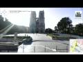

 :
: